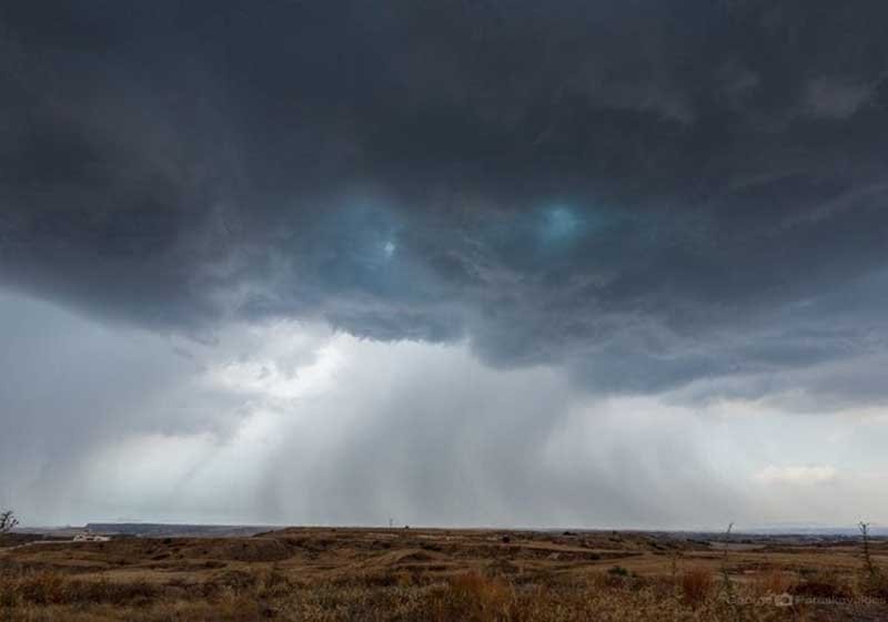
The department of meteorology has issued a yellow warning for isolated heavy thunderstorms, expected to affect parts of the island on Friday.
According to warning issued at 4.21 am the alert will remain in effect from 11.00 am to 6 pm.
The storms are forecast to intermittently impact various areas with increased risk over mountainous regions, inland, and in the north part of the island. Hail is possible with surface winds variable in direction and significantly strengthened at times. Rainfall rates could exceed 35 mm per hour.
The day will be partly cloudy to overcast, with isolated rains and storms expected in the morning, mainly on the west, south and north coasts. Progressively, starting at noon, rains and isolated storms are expected in the rest of the island, in mountainous areas, the north and the interior.
Temperatures will rise to 23C in the interior and the coasts, and 12C in the higher mountains.
Hail is likely during storms and winds will be mainly south-to-north-westerly, weak to moderate, up to 4 Beaufort and temporarily on the windward coast, up to strong, 5 Beaufort.
The sea will be rough.
Overnight will remain partly cloudy to overcast, with further rains or an isolated storm expected, on the west, south and north coasts. Temperatures will drop to 12C inland, 14C on the coast, and 5C in the higher mountains.
Winds will be north-westerly to north-easterly, and on the north coast south-easterly, weak, 3 Beaufort. The sea will be calm to slightly rough.
Over the weekend and on Monday a continuation of the same weather conditions is forecast, with rains and hailfall expected after noon, especially in mountainous and inland areas.
Temperatures will continue to fluctuate below the seasonal norms, with a slight rise expected on Monday.


Click here to change your cookie preferences