
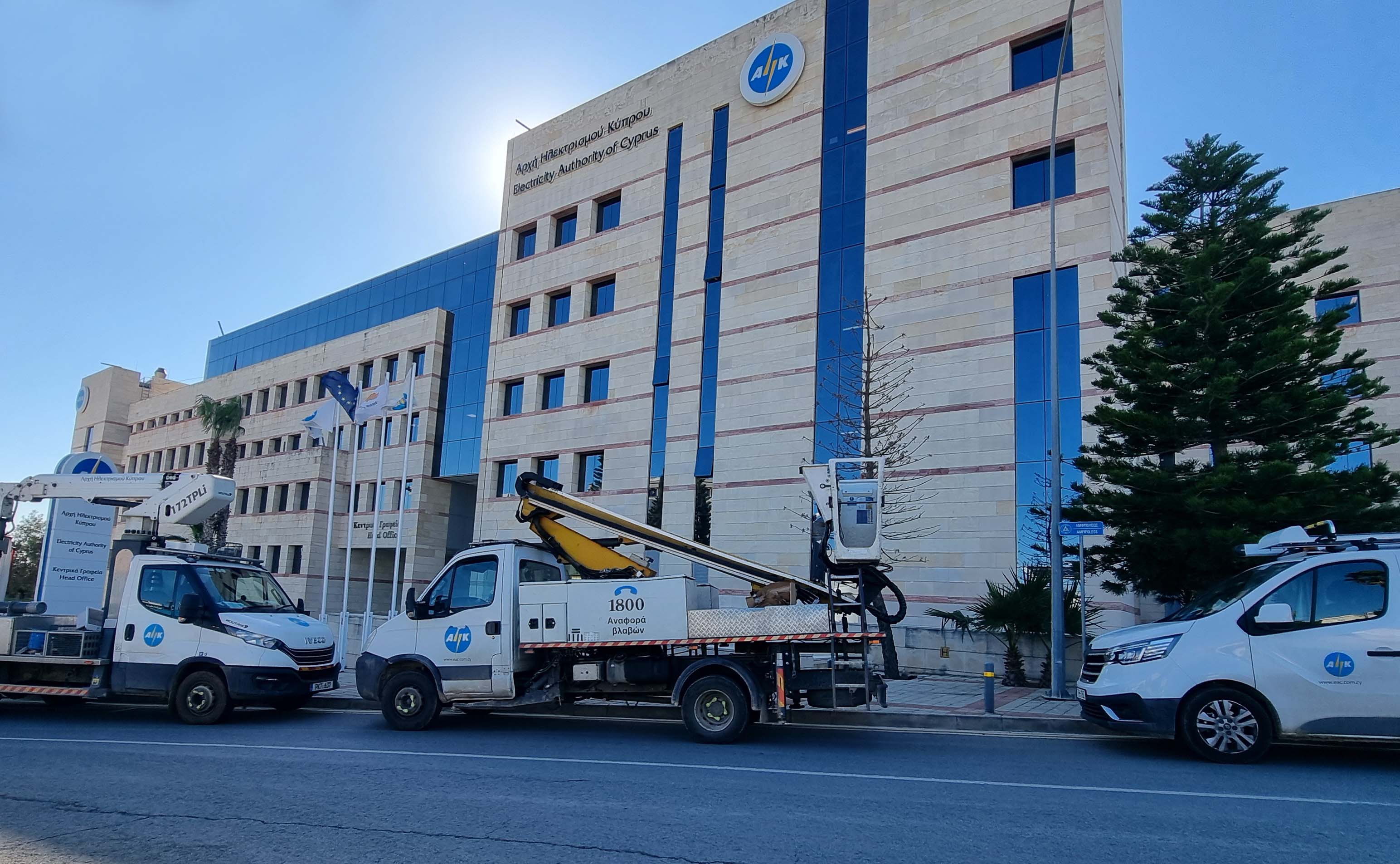
Authorities began imposing electricity cuts in different parts of Cyprus from 6.52pm on Wednesday, as demand exceeded available generation capacity.
According to an announcement by the Electricity Authority the affected locations have been divided geographically into groups, allowing the cuts to be carried out on a rotating basis so that no single area remains without electricity for an extended period.
The areas included in each group are listed below.
Nicosia district
Group 1: Strovolos, Stefanides shopping centre, Ikea and part of the Mall of Cyprus; Episkopio, part of Ergates, Politiko, Kampia and Kapedes; part of Arediou and Ayios Ioannis Malountas; Anayia and Deftera; Pano Amiantos; Platania and part of Kakopetria; Kardama, Kato Amiantos, Pelendri, Dymes, Potamitissa, Kato Mylos and Agros; and the Sia area.
Group 2: The Ayios Dometios area around the Zannetou and Delfon traffic lights; and Engomi, including the McDonald’s area, Hilton Park, 28 October Street and the Makedonitissa Tomb.
Group 3: Part of Avlona, Denia and part of Akaki; part of Astromeritis and Peristerona; Ayios Theodoros, military camps in the Atsa area and Evrychou primary school; Oikos, Orkontas, Gerakies, Kampos, Tsakistra, Mylikouri and Kykkos Monastery; Moutoullas, Kalopanayiotis, part of Pedoulas and Prodromos, Lemythou, Palaiomylos, Ayios Dimitrios, Treis Elies, Kaminaria and part of Kalianas.
Group 4: Engomi, the residential area around the Eleon swimming pool; Strovolos, including the Clerical School area, old Strovolos centre and side streets off Niki Avenue; Kantara Street, Strovolos Avenue and the Elaionon Street area; Athinon Avenue and the Stavrou area; Strovolos Avenue from Pepsi to Ayia Paraskevi church in Lakatamia; and Strovolos Avenue and Kyriakou Matsi Street.
Group 5: Lythrodontas and Mathiatis; the Alambra and Dali industrial areas; Potamia, Lymbia and part of Dali; part of Geri and Latsia-Geri Avenue; part of Peristerona and Astromeritis; Kakopetria, part of Kalianas, Sina Oros, Ayios Nikolaos Keo and Galata; the Geri special school area, Omonia stadium, the gymnasium and Epistrofis Avenue; the Geri sewage pumping station, the government building materials laboratory, the Penny Hill area and the Karaiskakio Foundation.
Group 6: Aglantzia west of Famagusta Avenue, the Siistris area, south of Aglantzia Avenue, the conference centre and Ayios Nektarios; Nicosia, including the Cyfield apartment blocks on Limassol Avenue, Kalypsous and Chrysanthou Mylona streets and the Central Bank; the Olympic House, part of Strovolos refugee settlement III and the Falcon area; Strovolos, including the Arodafnousa area, Alphamega and the surrounding eastern area; south of Digeni Akrita Avenue, part of Nikodimou Mylona Street, part of the Lykavitos residential area and part of Kallipoleos Avenue; Etha Engomi, Grigori Afxentiou Street, Ayios Georgios church and Ayios Dometios town hall; the European University, the Engomi nightclub area and Charilaou Stavraki Street; Archangelou Avenue, part of Parissinos, the Dias complex, the State Fair, Makario stadium and the Kadmou Street area; the Parissinos residential area, part of the Archbishopric plots, Fbis and part of the Stelmek plots.
Group 7: Part of Klirou, Kalo Chorio, Farmakas, Gourri, Kionia, Lazania, Machairas, Fikardou and part of Malounta; Arediou, part of Klirou, Palaichori, Apliki, Ayios Epifanios and part of Malounta; Ergates and Psimolofou; Kyperounta; the Grigoriou area and part of Anayia; Evrychou, Temvria, Korakou, part of Flasou, Linou, Katydata and Skouriotissa.
Group 8: Nicosia, including the Gabriilides traffic-light area and parts of Kennedy, Niki and Arsinoes avenues; Makariou Avenue from Lykavitos police station to the Aluminium Tower area; Digeni Akrita Avenue up to Ayios Antonios, Androkleous and Voulgari streets; Pepsi, Jumbo and Pavilion; the area west of Archangel Michael Monastery in Archangelos; the traffic police lights on Anthoupoleos Street; Ayios Neophytos church in Anthoupolis; the area west of the road towards Palaichori up to the road to Ayioi Trimithias; Pallouriotissa, including part of John Kennedy Street near the Praxitelis mosaic factory; and the area west of Limassol Avenue from Aluminium Tower to the Kalispera traffic lights.
Group 9: The Latsia industrial area and Latsia refugee settlements; Strovolos, including the Home Centre, IMC and Orphanides areas; central Latsia, Giannou Kranidioti, Archbishop Kyprianou and Spyrou Kyprianou avenues; Athalassa psychiatric hospital and Papakyriakou military camp; the area opposite the GSP stadium and central Latsia on both sides of Archbishop Kyprianou Avenue; Latsia, including the Seven-Up area and Archbishop Makarios III Avenue; and part of the Kokkinotrimithia industrial area and Mammari.
Group 10: Nicosia east of Niki Avenue, including Skopa and Alasia streets, the western section of Kennedy Avenue, 25 March Street, Riga Feraiou Street and Amfitritis Street up to Arsinoes Avenue; part of Platy Aglantzias, Metro supermarket, Skali and central Aglantzia; and Platy refugee settlement, Bank of Cyprus, Metro, Cyta, Ayia Filothei and areas along Kyrenias Avenue.
Group 11: Latsia, including Dimitri Stavrou Street and the Laiki Sporting road; the Fotiadis plots and Kallithea; Aglantzia, including the Arsiotis building; and the Aglantzia residential area and Larnacos Avenue.
Group 12: Byzantiou Street from the Kykkos lyceums to the Israeli embassy; parts of Strovolos and Lakatamia, including the Kokkines and Aspres refugee settlements towards the Sampson Farm area; Strovolos Avenue and its side streets up to the SEK building; part of Tseriou Avenue from the EAC substation to Pefkou Street in Lakatamia; Makariou Avenue, the Debenhams and Marks & Spencer area and parts of Stasikratous and Arnaldas streets; and Makariou Avenue from City Plaza towards its junction with Evagorou Avenue.
Group 13: Constantinoupoleos Street and the PEO-SEK plots; Lakatamia west of Strovolos Avenue; Strovolos Avenue, Ayios Mamas and Lakatamia; the Aspres refugee settlement and residential areas of Lakatamia; Strovolos, including Perikleous Street and the Stavrou area; Platy Aglantzias; Athalassa veterinary clinic between Larnacos and Athalassas avenues; Ayios Antonios and Stasinou Avenue; and Troodos, Prodromos, Pedoulas and Lemythou.
Group 14: Pallouriotissa, including the Panayia Pallouriotissa church area; Lykavitou, Thessalias, Lykourgou and Parthenonos streets up to Doryforos; ATI, the Agricultural Institute and Athalassa military camp; and the area between Orounta and Meneou, Mitsero quarries, Chapo and Nemesis, as well as Mitsero and Agrokipia.
Group 15: The area south of the road from the general hospital roundabout towards Athalassa; and Aglantzia, including the area of Larnacos Avenue towards BMH up to the Doryforos complex.
Group 16: The Papafilippou factory and the road from Kokkinotrimithia towards Paliometocho; part of Mosfiloti, Pyrga and Florentiades quarries; and part of Mosfiloti, Kornos, Sia and the Skyra Lima and Medcon quarries at Stavrovouni.
Group 17: The Kokkinotrimithia residential area and Makariou Avenue; the Kokkinotrimithia light industrial area; and Paliometocho.
Group 18: Dasoupolis, including A. Avraamidi Street and the Kosta Theodorou area up to Aretaeio Hospital; Nicosia and Engomi, including the Prodromos church area, Vasili Michaelidi, Pygmalionos and Sina streets, part of Metochiou Street and the US and Russian embassies; Dasoupolis, including Louis head offices and the handicrafts workshop; and Nicosia-Dasoupolis, including Foti Pitta Street, Cyta headquarters and the area towards Armenias Street up to Acropolis primary school.
Group 19: Lakatamia, including Kilikias, Kallitheas, Trikalon, Kypraleontos, Erymanthou and Agrafon streets; part of Pefkou Street and northwards to Spartakou Street; the military cemetery area, Makrygianni, Ayios Georgios, Amfitheatro and Riga Feraiou streets; the sports centre area towards Tseri and Tseri itself; Pefkou and Nikofontos streets; Pano Lakatamia towards Anthoupolis refugee settlement; Deftera, including the Poullos Mosaics area, Strakka and Green Valley up to Sarri supermarket; Athalassa-Geri, including Geriou, Athalassas, Grigori Digeni, Chatzipetrou, Fanariou and Pyrogiou streets; Dasoupolis, including Eleftheroupoleos, Ifigenias, Thermopylon and Tilepikoinonion streets, the Acropolis area and Cyta offices; the Shacolas retail store opposite the Mall of Cyprus and part of the Strovolos industrial area; the Shacolas Exhibition Centre; Aglantzia, including Larnacos Avenue, Katharis and Ethnikis Ellados streets; the College of Tourism and Larnacos Avenue; Pera Chorio Nisou, including Nisou primary school, Chalkanoros Avenue, the Chamatsou roundabout and Dali health centre; Pera Chorio Nisou, including Vasilikon and Tinou streets and the Nisou livestock area; Ergates, SPE, Episkopio, Psimolofou, Pera Orinis, Kampia, Analiontas and part of Kataliontas; Strovolos, including the Parissinos area west of the military camp and the Licensing Authority; the area between Archangelou, Elaionon and Makedonitissas avenues up to the Apollonio Hospital traffic lights and Lykavitou Avenue up to Carrefour supermarket; Ayios Prokopios Street and the Russian embassy area; Agros, Chandria, Agridia, Potamitissa, Dymes, Kato Mylos, Ayios Ioannis and Ayios Theodoros Agrou; Griva Digeni Avenue around Bridge House and the old water board offices; and Ayios Andreas, Ayios Dometios and part of Ayios Pavlos.
Group 20: Ayioi Trimithias and light industrial premises in the Kometis area.
Group 21: Ayioi Omologites, including S. Lambrou, Glafkou and Kyriakou Matsi streets; Pano Lakatamia towards Anthoupolis, including the police and Maronite school area; Alamanas, Ariadnis and Persefonis streets and the Polykarpou building; Ermylou Street; Anthoupolis, including part of the Cyprus Land Development Corporation plots; the Lakatamia gymnasium area; Pano Lakatamia towards Ayios Georgios Avenue and Kato Lakatamia, including the Cyta, amphitheatre and Koulouratou areas; Pano Lakatamia towards Pano Deftera, including the Trikkis area, Grammar School and the livestock zone; Nestou, Evinou, Acheiropoiitou and Ellisonos streets; and Pano and Kato Lakatamia, Makariou Avenue, SPE and Laiki.
Group 22: Strovolos, including the Aspres refugee settlement area up to Lakatamia airport; the area east of the EAC substation, Athinon Street, Aristofanous Street and Stavrou Avenue near Stavrou gymnasium; the Strovolos police traffic lights and the area around the SEK building; and Pallouriotissa south of Kennedy Avenue, including the Water Development Department headquarters and Ayia Varvara refugee settlement.
Limassol district
Group 1: Trachoni, Trachoni refugee settlement and Lanitis waterpark; areas along and west of Vasileos Constantinou Street, including Lord Russell, Gropius, Theofilou, Petrou Tsirou, Feidiou, Mendelssohn and Neokli Anastasiadi streets; and Archbishop Makariou Avenue and the Fisco Lotus Plaza area.
Group 2: Commercial and residential areas along Vasileos Pavlou Street; Makedonias Avenue near the Orphanides traffic lights, Orphanides supermarket and the Makarios III refugee settlement west of the supermarket; the area north of Vasileos Pavlou, Cyta offices, EAC warehouses, the Medochemie factory and Franklin Roosevelt Avenue near Karmi fruit market; Miltou Kavazoglou Street, the Sinevolos area, Makariou III Avenue from the Symillides traffic lights to the fire service and Apostolou Varnava Street from Makariou Avenue to Seychellon Street; the area between Miltonos and Parnassou streets; and Makariou III Avenue from Lanitio to the Ariel traffic lights and areas north of the Marios Tritoftides clinic.
Group 3: Fasouri pumping stations and Akrotiri village; Kolossi, Trachoni pumping stations, Tscherkezoi and Trachoni; the area of Limassol’s fifth primary school; north of Paphos Avenue, east of Kepler Avenue and west of Georgiou Averof Street, including Shelley, Aristippou and Ioanninon streets; Paramali and southern Avdimou; northern Avdimou, Prastio Avdimou and Pachna; Ora, Melini, Ayioi Vavatsinias, Odou, Sykopetra, Moni, Klonari, Akapnou, Sanida, Louvaras, Monagroulli, Vikla, Vasa Kellakiou, Dierona, Arakapas, Eptagoneia, Kalo Chorio, Parekklisia, Pyrgos, Kellaki and Prastio Kellakiou; and Spitali, Paramytha, Alassa, Lofou, Apsiou, Gerasa, Limnatis, Palodia, Korfi, Apesia, Ayios Therapon and Ypsonas.
Group 4: Ypsonas, including Ilias Kannaourou and Ayios Georgios streets; the Monovolikos primary school area and locations around Makedonias Avenue up to the motorway towards the port; east of the Ayios Athanasios industrial area towards Paniotis and Akadimias Avenue at its junction with Christaki Kranou Street; and crushing plants and small residential areas in Parekklisia.
Group 5: Areas north of the Limassol-Nicosia intercity road, east of central Ayios Athanasios and west of Paniotis; Kolossi, Kolossi refugee settlement, the Kolossi livestock area and the Ypsonas area; pumping stations and fishing shelters southwest of Kolossi, the ancient Kourion theatre, the SBA Administration Building, northwestern Akrotiri, southern Episkopi and Episkopi boreholes; Pissouri and the Pissouri livestock areas; Parekklisia north of the motorway up to the Kythreotis quarry, Ayios Tychonas, Pyrgos and Prastio Kellakiou; and the Kouris dam pumping station, Pano and Kato Kivides, Vouni, Alassa, Kantou, Sotira, Ayios Therapon, Ypsonas, Ayios Amvrosios and Souni-Zanakia.
Group 6: Areas between Makedonias Avenue and the old road, near the Dimadis shops and the Fiat showroom; and the area south of Spyrou Kyprianou Avenue and west of Ayios Athanasios Avenue and Dimitriou Kitrou Street.
Group 7: The area south of the motorway and west of Ayios Athanasios Avenue up to the Mesa Geitonia Cyta offices and Apostolos Andreas church; the area north of the motorway, central Ayios Athanasios and Panthea up to Chloridos Street; areas east of Ayia Fyla and north of the Limassol-Nicosia motorway, the water treatment plant and Panthea; Green Area, Paniotis, Prosforo, Stroggylos, western and northern Germasogeia and the oncology centre; areas east of 1 October Street and around Spyrou Kyprianou, Markou Drakou, Rodionos Riga, Fokionos Negri, Thermopylon, Imvrou and Georgiou Averof streets; the area south of Spyrou Kyprianou and Georgiou Neofytou streets up to Voreiou Ipeirou and Aisopou streets, north and east of Ayios Nikolaos cemetery up to Megalou Alexandrou Street; and postcode areas 4104, 4105, 4106 and 4108 around Ayios Athanasios.
Group 9: Areas west of Tsirio stadium and north of the Limassol-Paphos motorway, military camps and Pano Polemidia refugee settlements west of Giannou Kranidioti Avenue; Ayios Constantinos, Ayios Pavlos, Louvaras, Zoopigi, Kalo Chorio, Kapileio, Ayios Mamas and Trimiklini; Vasa Koilaniou, Malia, Koilani, Potamiou, Kissousa, Kato Platres, Omodos, Pera Pedi, Mandria Limassol, Foini, Arsos, Kouka, Mesana, Salamiou, Ayios Ioannis Paphos, Filousa Kelokedaron, Ayios Nikolaos Paphos, Arminou, Praitori and Kedares; and Fylagra, Mesa Potamos and small parts of Pelendri, Saittas, Trimiklini and Kouka.
Group 10: Ayios Georgios Havouzas, Kato Polemidia and Metanaston Street; areas south of Spyrou Kyprianou Avenue and east of Archbishop Makariou Avenue up to Nikou Evagorou Street and around Ayios Nikolaos cemetery; the area south of Kolonakiou Street, west of Stratigou Timagia Street and east of Pirantello Street up to Dimitriou Nikolaou Street; the Kalogries school area, Kirzis shopping centre, Riga Feraiou Street, Makariou III Avenue near Costa Coffee, Nikis, Chalkoutsa and Ayios Nikolaos; and Paphos Street.
Group 11: The area east of the Ayia Sofia-Spartiatis bridge and the junction of Makedonias Avenue with Nikou Pattichi Street; Makariou III Avenue from the Moditis kiosk traffic lights to the Symillides traffic lights; and the area between Nikou Pattichi and Ayia Sofia and north of Nikou Pattichi Street between Makedonias Avenue and Le Corbusier Street.
Group 13: Residential areas north of the Germasogeia coastal road between Christaki Kranou and Panayioti Tsangari streets; Kalogiroi and a small part of western Mouttagiaka; and the area between Miltonos Street and Omonias Avenue.
Group 14: Northwestern Kolossi and Erimi; Gladstonos Street around Pentadromos, Ayias Zonis Street, north of Thessalonikis Street and the Cafe Paris traffic-light area; east of Ayios Andreou Street, the Ayia Triada and municipal library area, the public gardens, Curium Palace Hotel, Ayios Nikolaos roundabout, Maximos Plaza and Enaerios; north of the municipal library, the second primary school area and western Gladstonos Street; and Pachna, Vouni, Koilani, Silikou, Potamiou, Pera Pedi and Ayios Therapon.
Group 15: Ayias Fylaxeos Street north of the Limassol-Paphos motorway, eastern Ayia Fyla and Lefkothea.
Group 16: The Moditis kiosk area, the Lemeco light industrial area, Pallados, Dimokratias and Alexandrias streets and the Land Registry, Social Insurance and Sala government buildings; areas north of Spyrou Kyprianou Avenue, including Steliou Kyriakidi and Ivykkou streets and parts of Christaki Ergatoudi and Vasileos Constantinou streets; the area between Ayios Ilarionos, Ierou Lochou, Melpomenis, Ayios Epifaniou, Spyrou Kyprianou, Grigori Afxentiou, Kosti Palama, Patriarchi Grigoriou V and Kritis streets, as well as Ayias Fylaxeos south of the motorway up to Spyrou Kyprianou Avenue; the area between Sofias Vempo, Kosti Palama, Ilias Venezi, Dimitri Makri, Aristoteli Valaoriti and Tagmatarchi Pouliou streets; Ekali, Vereggaria, Pano and Kato Polemidia, Polemidia self-housing and the Palodia-Saittas road, including Heritage and Pascal schools; the area around Debenhams, Bank of Cyprus, Laiki, Petousis Court and Hellenic Bank; areas between Platonos, Michael Georgalla, Ayias Zonis, Theklas Lysioti, Anaxagora and Zinonos streets; the area between the Serifou traffic lights and Dimokratias Street; the area around Akarnanias, Kolonakiou, Ayios Amvrosios and Edessis streets; the Vasa Skyra quarry, Moni, Asgata, Monagroulli and Vasa Kellakiou; and Doros, Koilani, Silikou, Lofou, Laneia, Monagri and Ayios Georgios Limassol.
Group 17: Areas north of Makariou III Avenue, including the Nafi, Le Corbusier and Petrou Tsirou areas; areas north and south of Paphos Street, west of the Omonia substation and on both sides of Omonias Street up to Petrou Iliadi Street; areas north of the Germasogeia nightclub road; Kato Polemidia, including Anagnostopoulou, Faidonos Koukoulle and Adamantiou streets; and Kapileio, Limnatis, Ayios Mamas, Laneia, Silikou and Kouka.
Group 18: West of Griva Digeni Street, including the fire service road area, Stratigou Timagia, Kefallinias, Georgiou Seferi, Chrysanthemou and Krinou streets, Oval Tower and part of Promachon Eleftherias Avenue.
Group 19: Eastern and southern Ypsonas, part of Tscherkezoi and southern Kato Polemidia; residential areas north of the motorway in Kato Polemidia and Ypsonas; and the Kato and Pano Polemidia self-housing areas.
Group 20: The southern section of the Ayios Athanasios industrial area and areas north of Sklavenitis supermarket; the Oerlikon and Domoplex industries; the third Ayios Sylas industrial area and part of the Ayios Sylas light industrial area; the northern, central and southeastern parts of the Ayios Athanasios industrial area; areas north of the motorway in Ayios Athanasios and Germasogeia up to the northern bypass; Rodionos Riga and Iapetou streets up to Codal Synto and Medochemie; the area north and south of Andrea Kariolou Street, including Jumbo, showrooms, Ayios Athanasios Street, Joy ice cream, IronFX, QLS and Kyproplast; the Ayios Sylas light industrial area, TEU Conservices, the Kogio factory and parts of Ypsonas; the area northeast of the Ayios Athanasios junction and Melis meat market; areas on both sides of Makedonias Avenue from the new port motorway to Ayias Fylaxeos Street; and north of the intercity road from the Mouttagiaka exit and Germasogeia river to the Amathounta substation.
Group 22: Areas north and south of Griva Digeni Street, from the Riala traffic lights to the Ayios Nikolaos roundabout.
Paphos district
Group 1: The Anatoliko area and golf courses; Pelathousa, Lysos, Peristerona, Meladeia, Skoulli, Goudi and Pano Akourdalia.
Group 2: Emba, Petridia, Tremithousa and Mesogi; the bypass between the Paphos entrance roundabout and the Pafiako traffic lights, including the Esso, Eko and DKS areas; the Agricultural Research Institute at Acheleia; and Sapa biological treatment stations.
Group 3: Northern and central Kissonerga, Tala, Stefani, Ayios Neophytos and part of Kamares; and part of Tala and Kamares.
Group 4: Geroskipou, including the Athinodorou Beton area, Sedigep, the old Koloni slaughterhouse, Koloni, Acheleia and part of Ayia Marinouda; Cosmoplast, Makariou Avenue and the central square up to Cosmoplast; and the road from the old KEN army camp to the new Geroskipou primary school in the Ayioi Pente area.
Group 6: Mandria, Timi, Anarita and the Anarita KEN army camp.
Group 7: The area north of Ayion Anargyron Avenue towards the Universal plots.
Group 8: The eastern Mouttalos area, part of Ellados Avenue, Athinas, Thermopylon and Fellahoglou streets, Capital Hotel and Kings Gardens; the road from the new EAC offices to the hospital roundabout, Argaki Vasilikou, Ayios Neophytos gymnasium, up to the end of Andrea Vlami Street, part of Anavargos and Mesa Chorio; Chlorakas, Lemba, Kissonerga, Emba, Archbishop Makariou Avenue in Chlorakas and part of Eleftherias Street; and the McDonald’s area, Neon Mall, the Paphos-Geroskipou-Konia light industrial area and the municipal wholesale market.
Group 9: Part of Kouklia, Nikokleia, Souskiou, Fasoula, Mamonia, Trachypedoula, Ayios Georgios Paphos, Prastio Paphos and Kidasi.
Group 14: Eleftheriou Venizelou Avenue up to Kykkos lyceum and Nikolaou Nikolaidi Avenue up to the new court traffic lights; the Vasiliko residential area, from Sklavenitis supermarket to Papantoniou bakery and Evangelismos polyclinic; part of the Mesogi industrial area, eastern Chlorakas up to Diplarkakia, Alexandrou Ypsilanti Street and Dasoudi park; the wider old market area, the central Bank of Cyprus branch, Palia Ilektriki and Kennedy Square; and the Chlorakas area bordering Paphos, from Myrra tavern to TimeOut, the Turkish Cypriot cemetery area, Neapoleos and Akamantidos streets.
Group 15: The Pafiako stadium area and Era supermarket.
Group 18: Areas on both sides of Alexandrou Papagou Avenue and Kinyras Street up to the new courts, including the Tepak and technical school area; the Peyia residential area; part of Peyia, Ayios Georgios Peyias, Sea Caves and Toxeftra; and part of the Aphrodite Hills residential area.
Larnaca and Famagusta districts
Group 1: Southwestern Kiti, the Kiti light industrial area and Tersefanou; the Salamina stadium area, part of Spyrou Kyprianou Avenue, the Siantonas-McDonald’s area and the Debenhams area; Xylotymbou and the stadium area in Dasaki Achnas; the Kokkines area in Ayia Napa; the Fanou area and playing fields in Ayia Napa; and Sia, Kornos and Delikipos.
Group 2: The Sklavenitis area in Larnaca; Drosia in Larnaca; and northern Oroklini.
Group 3: Mari, Governor’s Beach, Kalavasos, Tochni, Choirokoitia, Asgata, Kato Drys, Vavla and Lageia.
Group 4: The Kokkinos Kremmos area in Paralimni.
Group 7: Ayia Triada, Malama, Vrysoudia and Protaras Avenue from the Eko petrol station to Laxia tavern; and southern Ormideia and Xylofagou.
Group 8: Aradippou and the Aradippou livestock and light industrial areas.
Group 9: The area between Meneou and Dromolaxia, from Timios Prodromos church in Dromolaxia to the airport, and the Dromolaxia livestock area; the Peletico area in Aradippou and Kalo Chorio; and Pano and Kato Lefkara and Vavatsinia.
Group 10: The area from the Dipa apartment block to the old GSZ stadium in Larnaca, the Nikolaides arcade area and part of Ermou Street; and Paralimni, including the Paralimni-Sotira road and Melizona housing estate.
Group 11: The Fairways, Lidl, Radisson Blu, Katharis and Novel Tower areas in Larnaca.
Group 12: Vrysoulles; the former Larnaca refinery area; and the Pyla-Oroklini area near the motorway flyover.
Group 15: Agricultural areas of Sotira, Liopetri and eastern Xylofagou; Sotira and eastern Frenaros; Deryneia, from the Cyta area to the hospital traffic lights and Ayias Marinas Street; and the area from the airport towards the coastal areas of Meneou and Pervolia.
Group 16: Part of Kofinou, Anglisides, Kivisili, Alaminos and Mazotos; Pyrga; Mosfiloti and the western part of Pyrga in the Skyra Lima area; part of Zygi, Maroni and the Pentaschoinos area; part of Maroni, Psematismenos, Kalavasos and Choirokoitia; Troulloi; Avdellero; and Anglisides, Menogeia, Mazotos, part of Anafotida, Kivisili and Softades.
Group 17: Oroklini and Pyla.
Group 18: Paralimni refugee settlement, the Ayia Varvara area, Paralimni playing fields and the Ayios Panteleimonas area.
Group 22: The area north of Larnaca police headquarters and Archbishop Makarios III Avenue; the Mackenzie area; the Jumbo area and northern Livadia; the Vergina area and Zenon refugee settlement; rural and eastern areas of Sotira; northern Athienou; and Paralimni, including 1 April Avenue and Paralimni first primary school
Click here to change your cookie preferences