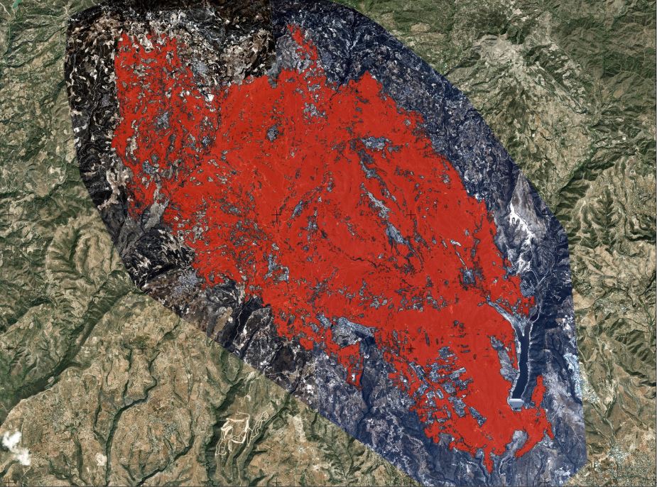
The final mapping of the areas affected by the recent wildfires has found that 104 square kilometres of land were burned, the Eratosthenes Centre of Excellence at the Cyprus University of Technology (Tepak) announced on Tuesday evening.
Using high-resolution, cloud-and smoke-free satellite images provided by the observation satellite constellation WorldView Legion, the analysis estimated the total burnt area at 104 square kilometers.
This is around 20 square kilometres less than the initial assessment by the centre on Thursday, July 24, based on Sentinel-3 satellite data, which estimated the area affected by the fire to be between 120 and 124 square kilometres.
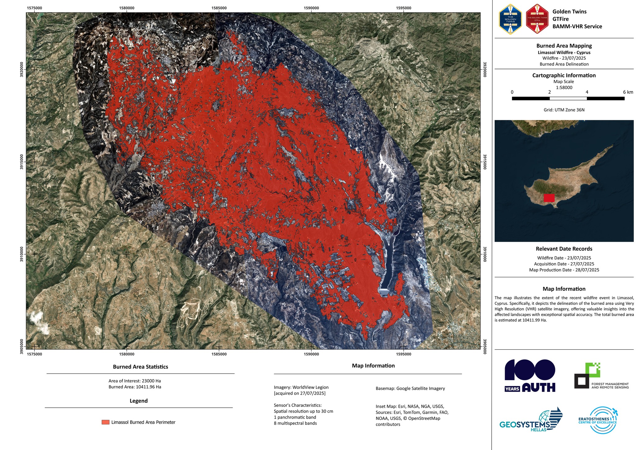
Earlier this week, Eratosthenes had confirmed that around 21 per cent of the affected area falls within the EU-designated Natura 2000 protected network, including the areas of Potamos Paramaliou, Ha Potami, and Koilada tou Limniti, saying that the land would take decades to recover.


Click here to change your cookie preferences