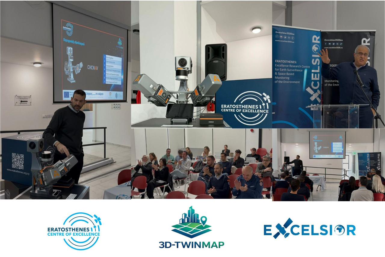
The Eratosthenes centre of excellence announced the completion of a mobile three-dimensional mapping project for the development of “digital twins”, which it says will improve digital public services.
Named “3D-Twinmap: mobile three-dimensional mapping for the development of digital twins”, the project’s stated aim is the advancement of 3D mapping, digital public services, and the adoption of digital twin technologies in Cyprus.
A digital twin is a detailed digital model of a place which documents information about it. Previously, the Cyens research and innovation centre had been in the process of creating something similar for Nicosia, known as iNicosia, while it had been reported last year that work had been underway for the creation of a similar project in the north.
The Eratosthenes centre’s project was coordinated by Marios Tzouvaras, and developed a high-precision mobile 3D mapping system using artificial intelligence to quickly gather dense geospatial data in urban areas. The technology is open-access and is as such available publicly.
According to the centre, the project has already demonstrated use cases showcasing the system, and, when implemented, will, as well as improving digital public services, support “national and European digital and green transition priorities”.
It was launched in October last year and was completed on Tuesday. It had a total budget of almost half a million euros.
Funding was sourced from the European Union’s recovery and resilience mechanism.


Click here to change your cookie preferences